
The UN General Assembly has passed a resolution to replace the traditional world map with a new world map that reflects the true scale of Africa
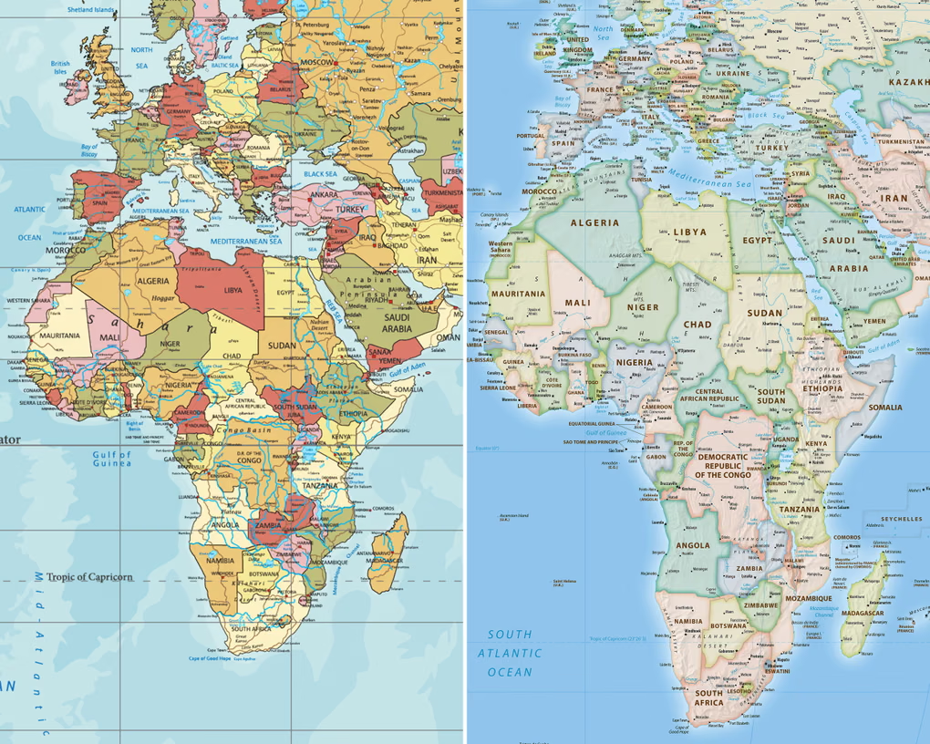
The UN General Assembly formally replaced the 16th-century Mercator projection with the more accurate 2018 Equal Earth design during a meeting at its New York headquarters.
A total of 164 countries supported the resolution. The United States was the only country to vote against it, calling the resolution “superfluous.” Six countries abstained.
Since UN resolutions are unenforceable, nations and organisations will not have to use the new projection exclusively or abandon the previous one. However, given the Mercator projection’s widespread use in education, technology and governance, the resolution could prompt updates to everyday technology and classroom curricula.
Togo, which championed a campaign for the resolution on behalf of the African Union, said the resolution “recognises and affirms that disproportionate cartographic representations, particularly those resulting from the Mercator projection, have had lasting cognitive, educational, cultural, geopolitical and socioeconomic effects, contributing to a drastic reduction in the perceived size of Africa and other regions of the world in the global collective imagination”.
While the UN vote carries no legal force, it is set to prompt revisions to map representations used by international organizations globally.
The Mercator projection, which has served as a standard reference since the 16th century, faces long-standing criticism for distorting geographical proportions—most notably depicting Greenland and Africa as roughly equal in size, despite Africa being approximately 14 times larger.
Critics argue that these spatial distortions understate the true physical scale, strategic importance, and developmental requirements of nations situated around the equatorial belt.
Backstory…
Flemish geographer Gerardus Mercator developed the Mercator projection in 1569 as a navigational tool for European seafaring explorers.
The inherent spatial distortion of his map stems from the mathematical impossibility of accurately representing a three-dimensional sphere on a flat surface.
Consequently, any attempt to project the globe onto a two-dimensional plane requires trade-offs in scale, shape, or area.
To preserve straight compass lines for maritime navigation, the Mercator projection accommodates the Earth’s curvature by enlarging landmasses near the poles while diminishing the relative size of regions along the equator.
In 2018, cartographers developed the Equal Earth projection, an equal-area map designed to correct these scale distortions and represent global landmasses in accurate proportion.
Change the map campaign
Online campaign group #CorrectTheMap said: “You could fit the United States, China, India, Japan, Mexico and much of Europe into Africa and still have land to spare.”
Togolese Foreign Minister Robert Dussey remarked to Reuters ahead of Friday’s vote that “a fair world begins with a fair map.”
“A map is never neutral,” he noted during an earlier UN briefing, stressing that spatial representations directly shape global perceptions and influence how continents and their populations are evaluated.
Aligning with this position, French Foreign Minister Jean-Noël Barrot announced that his ministry would cease all official use of the Mercator projection.
“Changing the map obviously doesn’t change the world. But correcting a representation that distorts it is already an act of truth,” he said.
Read Also: Why Africa Wants to Ditch Popular World Map